Tour Georgetown before you move to Washington
Washington, DC
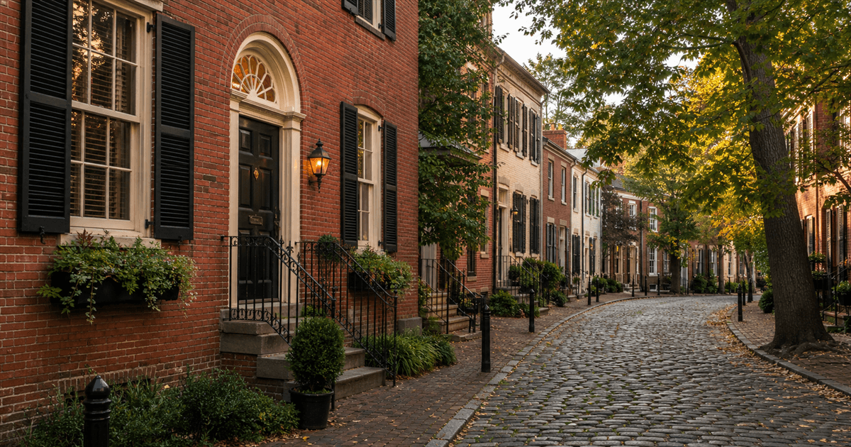
Georgetown packs three neighborhoods into one: the retail bustle of M Street and Wisconsin Avenue, the quiet Federal-era rowhouse blocks climbing the hill above them, and the C&O Canal cutting its stone channel through the middle. Street View covers all of it, which means you and your agent can walk the commute from a side-street front door down to the M Street shops, detour along the canal towpath, and finish at the Potomac waterfront park — the exact loop you'd live if you bought here.
Your agent drives the showing and you come along live on your own screen, talking the whole way. Every guest joins with a named cursor, so when you spot a dormered rooftop on N Street or wonder about the traffic on Wisconsin Avenue, you point and your agent sees exactly what you mean. House-hunting couples can join the same showing from different cities and finally look at the same block at the same time.
There's nothing to install and no account to create — your agent sends a link and a join code, and the code keeps the tour private to you. Use it to shortlist blocks before a weekend of in-person showings, or to walk the neighborhood one more time before you make an offer.
What it’s like to live in Georgetown
Georgetown is a hill neighborhood pretending to be a flat one. The retail spine along M Street and lower Wisconsin Avenue sits in the valley; everything residential climbs away from it, and the climb is real — the walk home from the shops to a house above P Street is a genuine hill in August. Locals split the neighborhood into recognizable pieces: the East Village toward Rock Creek, the West Village toward the university, Book Hill up around Wisconsin and Reservoir, and the flats near the canal and the waterfront.
The single fact that shapes daily life here is that Georgetown has no Metro station. Residents walk to Foggy Bottom, cross the Key Bridge to Rosslyn, or use the buses along Wisconsin and M — which is why proximity to a bus stop shows up in asking prices in a way that is invisible on a listing sheet. Parking is zoned and tight, university students concentrate in the blocks near campus, the waterfront and lower K Street have a flooding history worth asking about, and every exterior change in the historic district goes through the Old Georgetown Board. Weekends bring crowds to M Street; four blocks uphill you would not know it.
What the walk shows you that listing photos don’t
A Georgetown listing photo shows you a Federal facade. The walk shows you what is behind and around it: whether the house has rear alley access or a curb cut, how many steps rise from the sidewalk to the front door, whether the block still has its full tree canopy, and how far it really is to the nearest bus stop or grocery run.
Most usefully, it shows the noise gradient. On this kind of live showing an agent can walk a buyer from a candidate address down to M Street and back, so the buyer feels for themselves how many blocks of quiet sit between the front door and the Saturday-night crowd — a distinction every Georgetown resident knows by heart and no photograph has ever conveyed.
About the Street View imagery here
The commercial corridors — M Street, Wisconsin Avenue, the waterfront — are driven often and usually look current. The residential blocks above them refresh less frequently, and the C&O Canal towpath is a footpath, so where it appears at all it comes from Google’s backpack imagery rather than a car and may be considerably older than the street a block away. The viewer shows each panorama’s capture date, so your agent can flag the gap as you walk rather than let a buyer read a five-year-old streetscape as today’s.
What you'll see
- Federal-era rowhouses on the quiet uphill streets
- The M Street and Wisconsin Avenue retail corridors
- The C&O Canal and its stone locks
- The Potomac waterfront at the foot of the neighborhood
No account, no download — pick a showing name, send the link, and you're walking together in seconds.